


")


The UK will bask in warm sunshine this week as a mini-heatwave will send temperatures up to 25C – but the Met Office has warned of the looming prospect of thunderstorms in the weekend.
Clear and dry weather will be enjoyed by the vast majority of Brits as an area of high pressure moves in from the west, bringing with it above-average temperatures across the country for autumn the Met Office said.
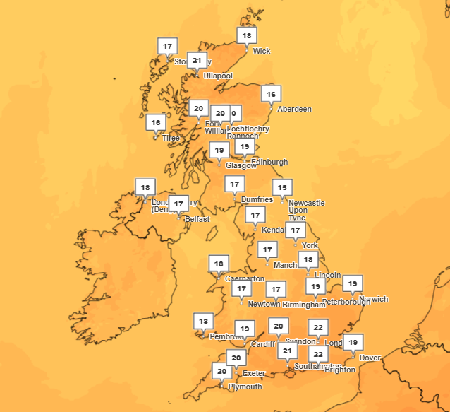
South and southeast England will see highs of 23 to 25C over the next five days, as temperatures sit in the high teens and low-to-mid twenties across the UK.
But as the week moves on and the area of high pressure shifts towards the east, there may be some “showers across the southern half of the country, on Friday and especially into the weekend,” Met Office meteorologist Alex Deakin told The Independent.

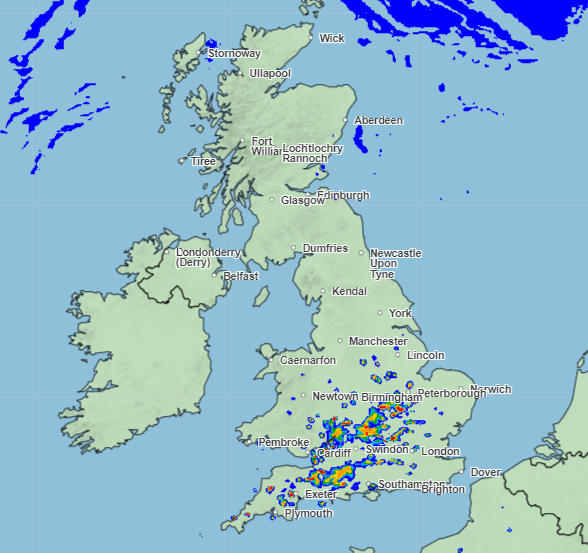
Weather charts from the forecaster suggest there could be up to 32mm of rain in some pockets across the south on Saturday.
Thunderstorms are “expected by day across the south” going into the weekend, the Met Office added in its long range weather forecast.
The risk of heavy showers and hail will also increase as the warm weather moves on and more typical autumn weather prevails.
The week ahead
North east Scotland will enjoy the peak of Tuesday’s weather with a UK-wide high of 23C as the warm front moves in.
“Most places enjoying a fine day on Tuesday, plenty of September sunshine. It will feel pretty pleasant, certainly warmer than last week,” Mr Deakin said.
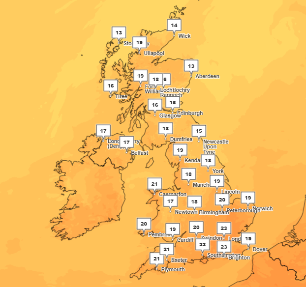
Wednesday may see some cloud in the East Midlands and eastern coast, but warm temperatures will remain and the cloud may disperse throughout the day.

Northern Scotland will see temperatures as far as 6C above the average temperatures for this time of year.
Thursday will see the week’s peak temperatures with highs of 25C in the south and the south east – an area which will see temperatures consistently in the low-to-mid temperatures throughout the week.
But there will be “quite a big variation” in the temperatures for Thursday. Mr Deakin said: “We’ll see some morning mist and fog, and perhaps some low cloud to start the day particularly in central and eastern parts.”

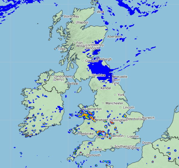
Friday will see “quite a grey start” as the weather begins to take a turn going into the weekend, as the possibility of intense rain approaches.
Weather will be “more unsettled across southern half of the UK from Friday, with scattered showers developing here,” Andrea Bishop, of the Met Office said.
“Showers becoming more extensive across southern areas over the weekend, with the increasing risk of heavy showers, hail and thunder,” Ms Bishop added.

The Met Office forecast reads: “Settled but often cloudy across many central and northern areas through the weekend, with the best of the sun found to the west of high ground, whereas showers and some thunderstorms are expected by day across the south.”
Going into next week, cloud, rain and strong winds are expected to push in from the west as “heavy rains” grip the southern half of the UK.


